The Historical Impacts of Super Typhoon Bavi
Jared Young - Senior Meteorologist/Marketing Assistant
Earlier this month, Super Typhoon Bavi developed quickly into a historical cyclone over the W’rn Pacific Ocean. The system created widespread destruction across Guam and the Northern Mariana Islands as it passed directly over Rota on the 06th with sustained winds reaching approximately 156 knots (180 mph). This system marks the strongest ever to make landfall over Rota. Bavi then barreled directly towards Taiwan, the N’rn Philippines and S’rn Japan through the rest of the week, remaining a formidable system until continuing inland over E’rn China between the 11th and 12th.
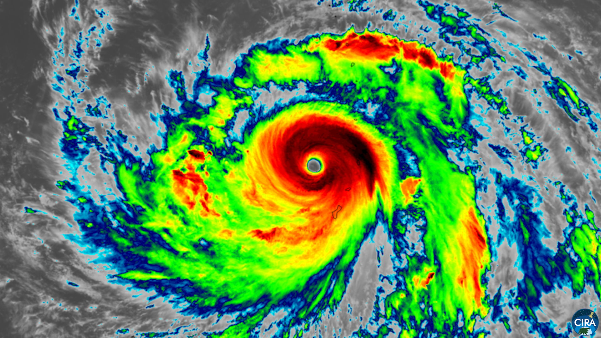
Figure 1: Infrared satellite imagery of Super Typhoon Bavi prior to near landfall over Rota. Image courtesy of GEO-KOMPSAT satellite (CSU/CIRA & KMA/NMSC).
Bavi initially was alerted as a new invest on June 25th just to the east of the Marshall Islands. Warm sea surface temperatures (SSTs) approximately 2 degrees Celsius higher than normal, in addition to low vertical wind shear, allowed for a favorable environment for cyclogenesis through the next several days as the system made W’ward progress towards Guam and the Northern Mariana Islands. These warm SSTs and low vertical wind shear both correlate with the current El Niño trends across the Pacific Ocean.
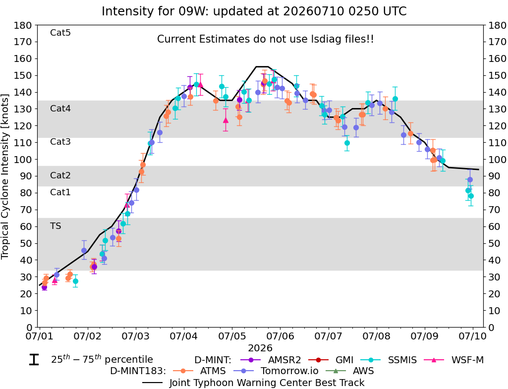
Figure 2: Estimated Tropical Cyclone intensity of Bavi between July 01 and July 10. Chart is courtesy of Cooperative Institute for Meteorological Satellite Studies
On July 01st, the storm intensified into a tropical depression, with the system then strengthening more notably thereafter. As shown in Figure 2 above, Bavi was able to undergo rapid intensification from a strong tropical storm into a Category 5 super typhoon in a little over 24 hours between the 02nd and 03rd. Eyewall replacement cycles which occurred as the system approached Rota through the morning of the 06th are responsible for the slight fluctuations in the strength of Bavi as shown in Figure 2. A strengthening in the eyewall occurred just prior to the system’s arrival to Rota early on the 06th, causing winds to ramp up even stronger as the system moved across the Northern Mariana Islands. Bavi also brought heavy rainfall and enhanced storm surge to Guam as it passed to the north, resulting in catastrophic flooding to the island.
Bavi then remained as a Super Typhoon while lifting WNW’ward through the later hours of the 06th into the 07th, prior to finally weakening during final approach to the N’rn Phillipines, Taiwan and S’rn Japan through July 10th and 11th. While the system weakened, Bavi also expanded, generating widespread flooding and high winds across these regions before making landfall in E’rn China later on the 11th and weakening more notably thereafter.
In order to keep our captains informed of any possible tropical development in the West Pacific (as well as other regions of the world), WRI offers complimentary tropical summaries and alerts to clients who utilize our customized forecasts and/or SeaWeather platform. These alerts can give plenty of advance notice to ensure that you and your vessel remain out of harms way from tropical cyclones around the globe. Contact our office to learn more about how you can stay up to date on any current tropical development in your region of the world.